|
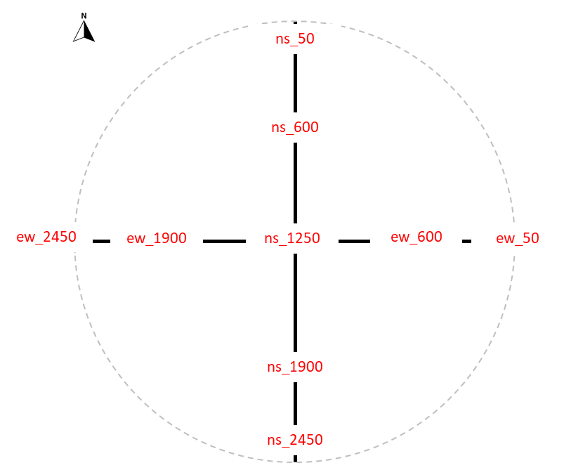
Hello OF team: I'm writing today because we've encountered a problem with Arena Mobile and GPS data collection. Let me explain. In a project we're working on, aware of the inherent error of smartphone GPS, we're collecting 9 GPS points along our two transects (see below). The idea is to average these points later to refine the transect locations as much as possible.
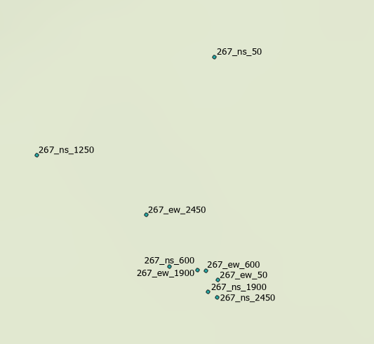
The problem is that we downloaded the initial field data and discovered that what should be two cross-shaped transects (Northwest and Westwest) is a disorganized set of points with no clear meaning.
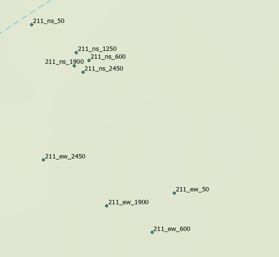
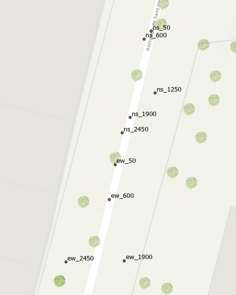
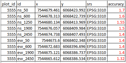
After investigating, I believe I've identified the problem: AM's "Location Accuracy Threshold" option retains the GPS coordinate value when the accuracy (provided by the sensor) falls below a specific value. The problem lies in the inherent variability of GPS. If, when recording a point, the sensor happens to indicate that the error is less than the defined accuracy value, it quickly records that GPS value without allowing time for it to stabilize. In fact, I've surprisingly found that it sometimes provides the coordinates in less than a second. To solve this, I configured AM with the following settings: Location accuracy threshold: less than 1 m (an impossible value) Location accuracy clock timeout: 30 seconds GPS locked: Enabled This forces the GPS to stabilize, but AM continues to record the value provided by the sensor after 30 seconds, which can introduce an error (if the sensor reading changes during that time). For example, the points in this image should form a straight line (more or less straight), and you can see the result (better than in the transect, but still with an error that doesn't correspond to the accuracy data recorded by the sensor).
I'm researching what other apps (qField, Field Maps, etc.) do, and here's my proposed improvement: they have an option called "Averaging Positioning Functionality," which collects GPS sensor readings over a period of time (for example, recording 10 readings in 30 seconds) and averages the result. I think this would improve GPS measurements in AM mode. Regarding GPS, another improvement would be to allow users to select an external GPS device (if it's connected to the tablet) directly from AM and use its data Regards, Oscar |
|
Dear Oscar, |
|
I think that seeing the averaged result would be sufficient if the AM documentation clearly explained how that average is calculated. Thanks, OF team! |