|
Good morning, I need to generate a survey for a study area and would like to know how I can obtain the areas_per_attribute.csv file. Thank you |
|
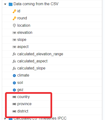
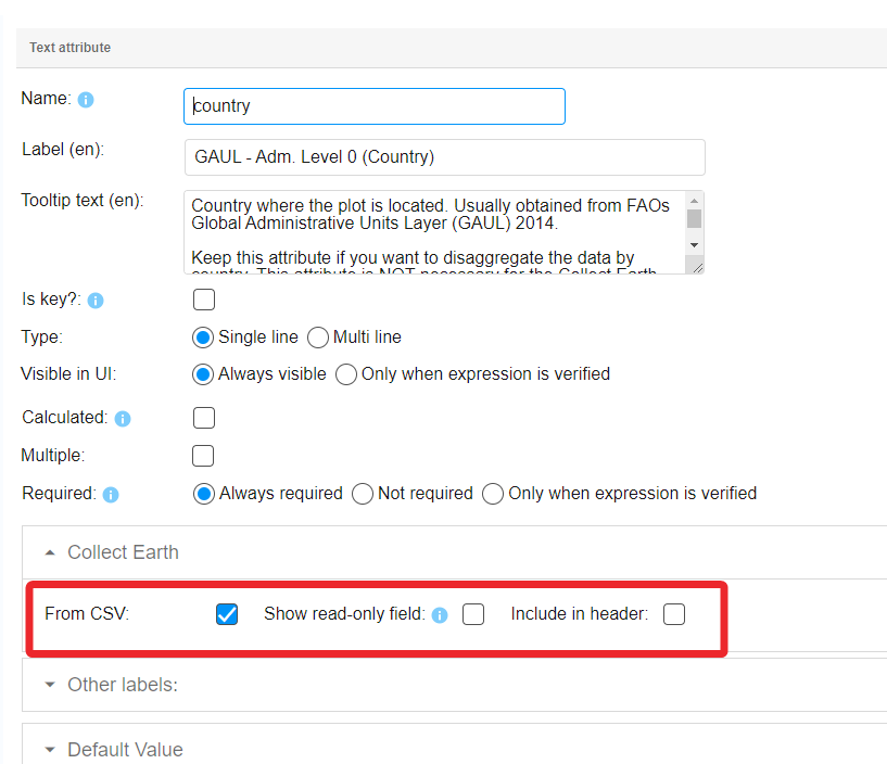
The areas_per_attribute.csv file contains information that allows Collect Earth to relate the data collected for a plot to the area of a region (or any type of polygon). We use the simple concept of the expansion factor to assign areas (in hectares) to the information for a plot. Simply put. Collect Earth, after you have collected the data, knows how many plots you have in your region of interest. The areas_per_attribute.csv file tells CE how big is the region. CE then divides the AREA of the region by the NUMBER OF PLOTS in the region, and assign that value to the area data of the plot. EXAMPLE : you have 1.000 plots inside region A. The region A is 100.000 hectares --> The expansion factor (or area assigned to each plot) is 100 hectares. For this approach to work, CE needs to know what is the region that a plot belongs to. For instance, we normally add the information of the country, province, district (extracted from the FAO GAUL 2014 Administrative Level Units database) as a column on the CSVs generated in the Collect Earth Grid Generator ( https://collectearth.users.earthengine.app/view/collect-earth-grid-generator ). Of course, we also need to have the country, province and district attributes in the survey. These attributes are marked as coming from the CSV ( meaning that the values are not input by the user on the form, instead they are read from the CSV containing the plot locations)
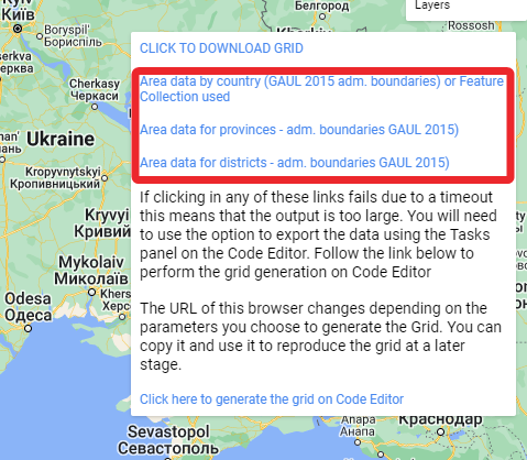
SO FINALLY : you need to generate the file that contains the areas for the province. If you used the CE Grid Generator, then you can obtain it from the menu on the top-right after you run the grid generation process. ( Example of Italy click Generate Grids )
If you download the file for the regions (GAUL level 1) then you get a file with this contents, province name and area in hectares.
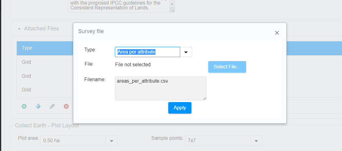
Finally, you need to add this CSV to your survey, as the areas_per_attribute.csv file. In the Collect Survey Designer, at the info tab of the survey:
|
|
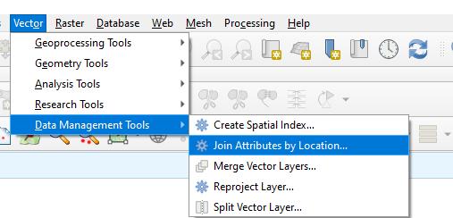
ALSO : If to generate your plots, you did not use the Collect Earth Grid Generator, then you need to use the shapefile that you used to define the AOI of your CE assessment to define the areas. Say that you used a shapefile with basins, i.e. 5 basins in Namibia. You need to add an attribute to your survey that is called basin_id (or similar) that you can use to know to which basin the plots belongs (considering that the shapefile you have has information on the basins ids). Then in the CSV file with the plot locations you need to add a column, also called basin_id -- IMPORTANT THAT THE NAMES OF THE HEADER IN THE CSV AND THE ATTRIBUTE ON THE SURVEY COINCIDES ). In that basin_id you need to put the information of the basin that the plot blongs to. You could do it for instance through the QGIS "Join Attributes by location"
Then, also in QGis you could get the area in hectares of your basins (using a calculated attrbute on the attribute table witht the $area keyword for instance ) You would then end up with a CSV like this :
That is the aareas_per_attributes.csv file you should use. |