|
Hi! I’ve been using Collect Earth Desktop with Planet imagery (via the NICFI program) for Land Use Change monitoring in Africa. As of today, 1st of April 2025, the high-resolution mosaics from Planet are no longer loading in the browser window when accessing it in Earth Map or though the Collect Earth automatic pop-up https://openforis.org/fileadmin/planet.html . I checked my survey settings and everything seems to be configured correctly. Has the access to the Planet/NICFI data been finally discontinued for good? If so, are there any suggested alternatives for high-resolution imagery in Collect Earth for land use/land cover interpretation? Would really appreciate any updates or official information on this. Thanks in advance! |
|
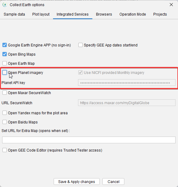
As announced by Planet, their agreement with NICFI (Norwegian International Climate and Forest Initiative) to fund free access to tropical forest monthly basemaps ended at the beginning of 2025. As of March 31st, access to this imagery has been discontinued. We understand how valuable this data has been for land monitoring, and we’re actively working on a solution that may allow users to access Planet imagery through their own accounts or credentials in the near future. In the meantime, if you’d like to disable the Planet browser window in Collect Earth, follow these steps:
This will prevent the window from trying to load the now-unavailable imagery. We'll post any updates here as soon as we have an alternative in place.
|