|
Hi OFT, I want to prepare the CSV file for the plots. Reading the manual, and other posts here I understand that the file needs to respect specific minimum requirements in the structure (i.e ID, LAT, LON, ELEV, SLOPE, ASPECT, REGION) at a minimum. My questions are:
Thanks, itzam |
|
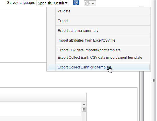
Hi Itzam, Are there upper (max) limits on the columns in the CSV? There are no limits, you can have hundreds of them. But of course, you need to make sure to add the attributes to the survey and set them as coming from the CSV. Are there any limits in the maximum number of characters the headers of the columns in the CSV file might have? No limits there. Does the header in the way is written matters, especially for the six main columns (e.g. ID vs plot_ID)? It does not matter although it helps readability if you use the same names than the attributes. Collect Earth complains if the names of the columns do not match exactly the names of the attributes they represent, but it is not a showstopper. If you want to make sure that the CSV is using the right structure you should always check the expected column order in Collect. Go to the tools in the survey editor and choose the option "Export Collect Earth grid template"
|
|
Dear OFT, Thanks a lot for your valuable information. Regards, itzam |

