|
How do I register a polygon (boundaries of a land holding) in Collect Mobile? |
|
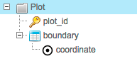
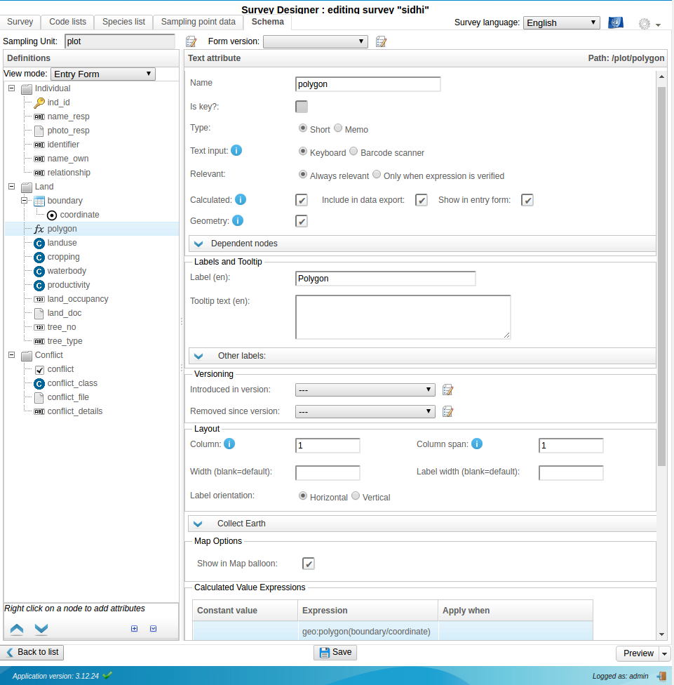
You create a structure similar to this:
You make boundary a Multiple (1:N) (Table layout) entity and coordinate a simple Coordinate attribute. Regards, Daniel |
|
Hi Sandip, Many thanks,
|
|
Dear Daniel, I tried this old advice/instruction, and it works in Collect-Data Management/Map, however it crashes in Collect-Mobile: how to solve? In Collect-Map I see only the (e.g. 4) corner-points; can they be connected to see a real polygon? This procedure results as 'data' coordinate-points; can I design/digitize also a polygon as sample 'area': at cluster (e.g. biotope-area) level to define the area to sample plots(e.g. biotope-elements) within? Joseph |
|
Dear OF Team: thanks for the improvement use of the polygon option with OF Collect & mobile with: polygon border-points/corners connected with lines and separate (center) points for information! The automatic zoom to the survey area selected through the dashboard is also a handy feature! JB |
Dear OF, do you have a solution to make/use polygon files in Collect Mobile and Collect Survey Designer, as explained in may Answer/Question below? Can this be done in a similar way as for Collect Earth? Joseph
See also: How to load polygon sample data in CE - May 2016