|
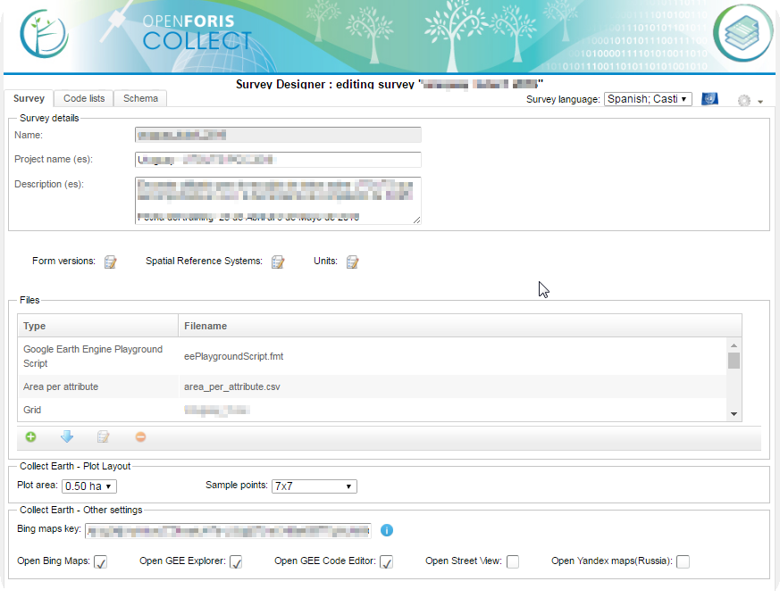
Dear OpenForis Team, I need to use my own sampling point. When I tried to create a new survey to collect earth doesn't appeard the sampling desing tab. Is this normal? How can I import my point without this tab. The sampling design tab only apear in blank or biophisycal survey types. Thank you in advance, Best regards. Inês Melo |
|
Dear Ines, Thank you for explaining your issue and uploading your files. I have now patched Collect Earth to fix this issue and you should be able to update it to version 1.5.8 ( when you open Collect Earth it will show you a window after a few seconds telling you if you want to update to the latest version, otherwise you can go to the Help menu->Check for Updates of Collect Earth ) In your survey you have declared that you are using the CRS EPSG:32628 , this means that the coordinates of the center of your plots should also be in that CRS! So the plots.csv file that you are using rightn now will not work as the coordinate was in EPSG:4326!! So, you can change the survey so that it uses the EPSG:4326 Spatial Reference System(CRS) in the main tab of hte Survey Designer, or you can adapt your plots so that they are in EPSG:32628. This for instance will work fine! LINK TO CSV Notice how latitude and longitude are using the correct CRS system. |
|
Dear Ines. Can you put your survey (CEP) and your sampling points (as CSV or Excel or whatever) somewhere so that I can get a better idea of where the problem lies?? Normally you should add the CSV file with your sampling desiong inside the CEP using the file manager in the Collect Survey designer... Useful info : Creating the sampling design CSV files : LINK Finally, if you have the last version of Collect (the application to design surveys) it will validate the CSV files that you add to the survey so that if they are not good for the survey design it will tell you what the problem is!!!
You can even get a CSV file (click on the Download template button ) with an example of how the CSV file should look.
|
|
Dear Open Foris Support, Thank you for your answer. It clarified the initial problem but created a few more. Sorry for the questions but I really can't solve them with user manual, youtube or online links. What's the difference between files: generic, area per attribute, grid, google earth engine playground script, saiku query? As you suggested, I tried to import another grid file. I download the template and use the same order to change coordinates. The collect said: Invalid file type. The expected type is CSV (Comma Separated Values). I saved as correctly the file. I also tried with the same doc (template) and just deleted some lines and saved as again with the right extension but it didn't work either... My windows office is in portuguese but I tried with another computer in english and also changed the region definition to switch comma and points. Nothing works. I changed the coordinate system in cep file to EPSG:32628 for UTM 28 (Guinea-Bissau plots). The following link have .cep file, original excel file and tentative .cvs file (only with 1point). https://www.dropbox.com/sh/0phqkssqj58oefc/AAD7Vu6bZea64rbyRw0SvQdma?dl=0 With this cvs file, the software accept but there are an error on coordinates. Additionality, when I tried to import some cep file in other computer (collect) to edits survey, it doesn’t recognize the file, always ask a zip file. Thank you and sorry for long text and a lot of questions. If there are another manuals or documents that can help I will appreciate. Regards, Inês Melo |


