|
Hello there, On installing CE and GE on a machine that has never run it before in absence of internet connection or under a slow internet connection i experience very slow performances and errors on loading the imagery. Any suggestion on how to get over this issue? Cheers, Alessio |
|
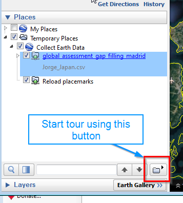
Dear Lauri, You are right, Google Earth Voyager does not work with version 7 of Google Earth Pro!!! The Good news is that there is an even simpler method!!!So, you will need to use the Touring feature in Google Earth using the plots loaded though Collect Earth. Say that you have open Collect Earth with your project. You get a folder in your "Temporary places" folder. You select it and you click on the Tour button to start the tour...simple as that!
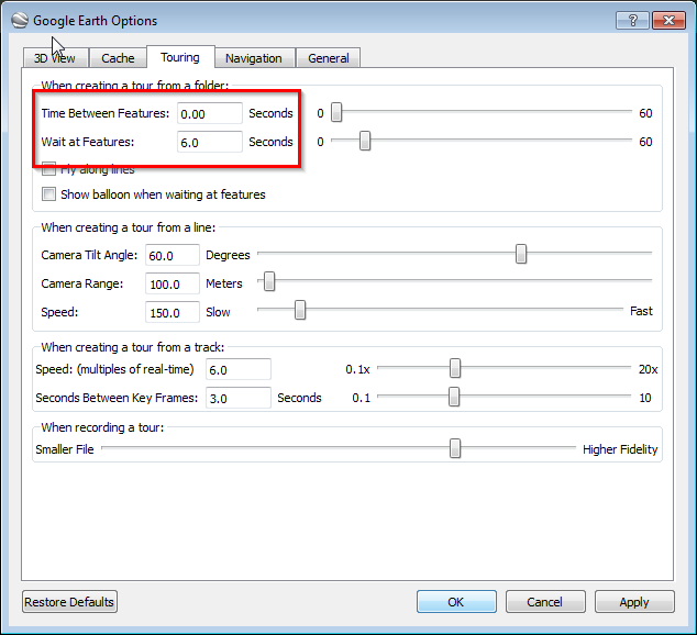
To improve the process make sure to set up the Google Earth options for touring as in the picture! If you have a fast connection you can decrease the "Wait at features" setting to 2 seconds, this way the process of caching will be faster!
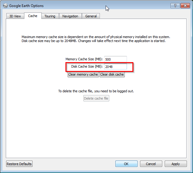
This will put the imaery in your cache. Also make sure to maxify the cache used by Google Earth, see image!
|
|
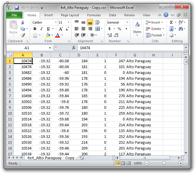
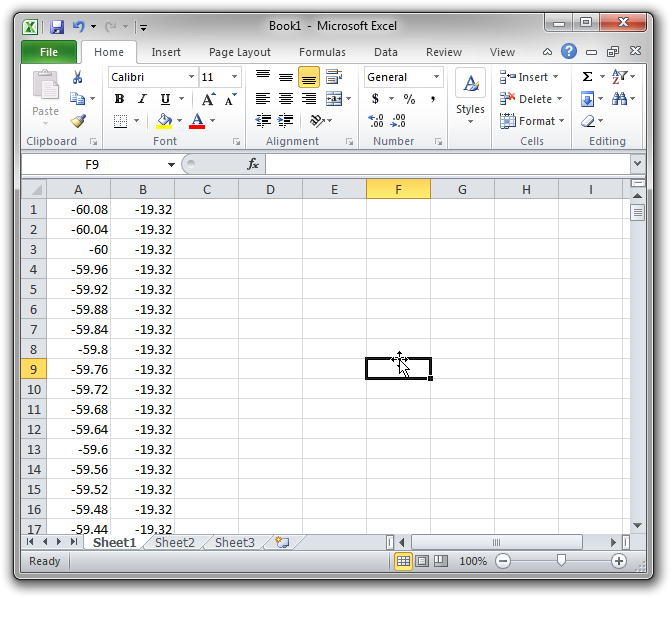
Hello Alessio, In order to have access to Very High Resolution Images of the plots through Google Earth when the Internet connectivity is limited I propose you to use Google Earth Voyager. This program allows you to "program" Google Earth to systematically visit the plots that you are going to assess when you have Internet connectivity. WHEN GOOGLE EARTH VISITS A PLOT AND THE IMAGE IS LOADED IT WILL REMAIN IN THE SO CALLED CACHE FOLDER! Attention: this folder can only contain 2 Gigas of imagery! So if you have a whole country it will not be enough. My advice is then to repeat the process that is going to be described province by province. When GE Voyager has finished with a province save the cache folder separately. Then start with the next and so on. When you have to work on the provinces make sure that the right cache folder is pasted into the Google Earth cache. How to cache:So first, you should open the CSV file or CED file where the coordinates of the plot-centers are located. Take the latitude and longitude columns and copy them. Create a new CSV file where now you will have the coordinates in the order LONGITUDE, LATITUDE.
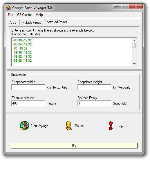
Save this resulting style sheet as a CSV (MD-DOS). Now you can open Google Earth voyage and copy/paste the contents of the CSV file ( open it in Notepad or similar) into the dialog where you can program the specific locations that Google earth will travel to:
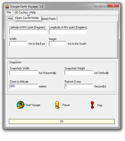
VERY IMPORTANT: Follow the instructions from GE Voyager ( Menu Help->Help Contents->Quick Start ): After GE Voyager has "traveled" through the plots the images will reside in the Google Earth Cache ( you can access the Google Earth Voyager menu.
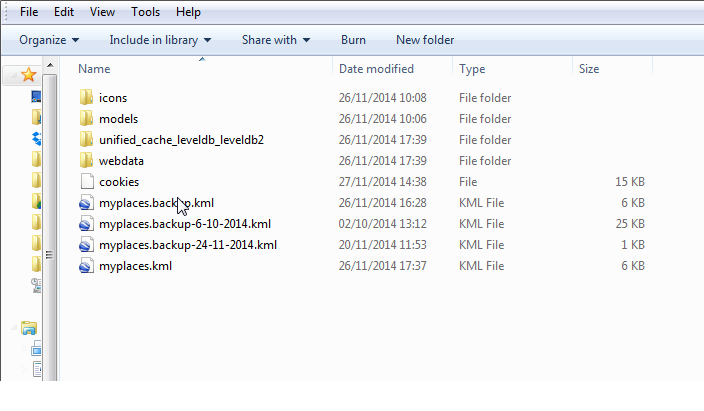
This will open the file explorer, now you could copy the files that you find therein into a USB key and paste them into the Cache folder of Google Earth in other computers so that they too have access to the same cached images.
Of course it is not ideal to use Collect Earth without an Internet Connection but I hope this helps a little in the process! |
|
Hi, have you ever tested this Voyager? According to my experience it does not work with Google Earth 7.x because Google changed method for caching imagery data. |
|
Hi! I am a bit confused, which one of Touring or Voyager is the most efficient to cache for 6,000 points? I might not have a choice as I have been unable to make Voyager work on Google Earth 7.x (not Google Earth pro). If Voyager is better, I will have to make it work. If Touring is better, then I can ignore my problem with Voyager. Thanks for the guidance! Florence |
|
Hi Florence Just go with the method described with touring as the voyager method is obsolete. |

