|
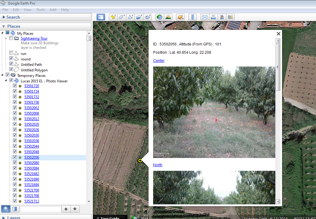
Hi OFT, I would like to ask you whether there is a way to use information gathered within LUCAS project of EUROSTAT in parallel with collect earth. Is there any past experience? This could enhance the image interpretation results. Here is the LUCAS 2015 Photo Viewer : LINK Thanks! itzam |
|
Dear Itzam, The LUCAS 2015 raw data can be downloaded from this page : LUCAS 2015 I have taken the CSVs with the data for each country and have generated a KMZ per country that can be loaded in Google Earth. This way you can visualize the LUCAS 2015 plots and their pictures (only the thumbnails, not the full resolution pictures as they are not online) . In any case LUCAS is only available in Europe where in general we have very good coverage of Google Earth and even of Google Street View (remember you can move the "little man/peg" in Google Earth to see if there is Google Street View Imagery. The KMZs for the larger countries are a bit big but I think they can be handled properly in a medium/good computer. Here is the ZIP file with all the KMZs : DOWNLOAD ALL LUCAS 2015 KMLs
Hope this imagery helps you! You can download teh ZIP file with all of the KML |

