|
Hello, I have seen in your Twitter page that now the NICFI procured monthly basemaps are available through Collect Earth! This could be a great resource for the monitoring of restoration or to cover areas where there is no good Google Earth imagery. What I did not understand is how we can use this data, could someone explain or send some documentation? |
|
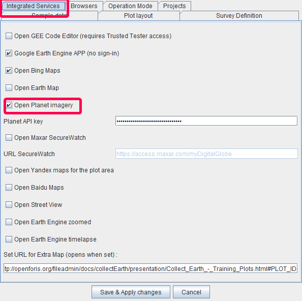
We are really happy too of having this new resource to add to the list of current integrations! First of all you need to Update Collect Earth to the latest version 1.12.3! If you open Collect Earth you will be automatically asked to update (after a few seconds), click on "Update Now". You can also go to the main menu "Help->Check for update of Collect Earth" Afterwards you will need to restart Collect Earth so that all the changes take place, and go to the button "Properties" and select the "Integrated Services" tab, selecting the Planet labs integration option! DO NOT change the Planet API Key value. Click on Save and Apply
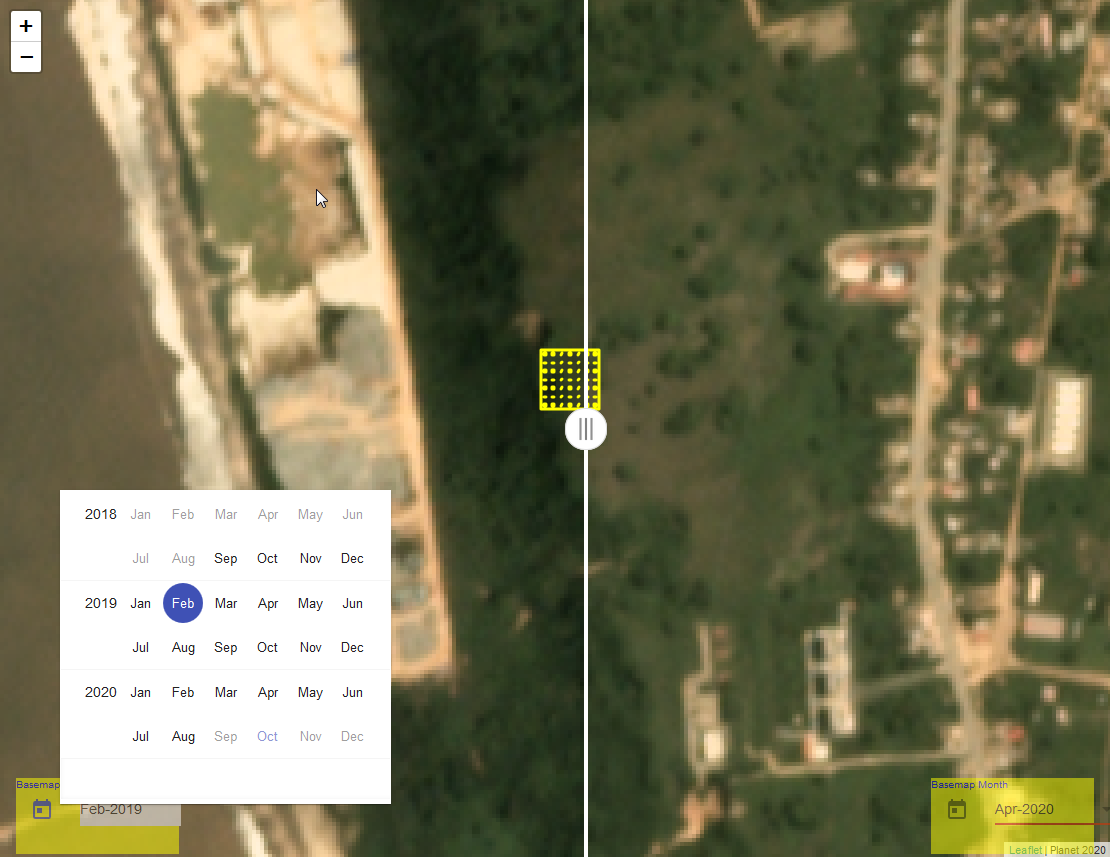
Now when you click on a plot you get a new window with a slider and two calendar widgets where you can choose the months for the basemaps to compare!
The Planet imagery that has been purchased by NICFI is available in areas around the tropics only. Take a look. If you have plots outside these areas you will just see a grey image...
|


