I randomly select 10000 samples and judged the their landcover type. How could I calculated whether those samples has very high resolution images on Google Earth? Thanks?

asked 01 Dec '20, 08:25

Xiaoyi%20Wang's gravatar image

Xiaoyi Wang
113
accept rate: 0%

edited 01 Dec '20, 08:26

sorry, re-reading your question I think I might have answered something different you are asking :)

Did you already collect data with Collect Earth? Did you include a question on whether there was Very High Resolution imagery available?

(01 Dec '20, 13:37) collectearth ♦ collectearth's gravatar image

Hi,

you could use a very simple survey (use the Collect Survey designer to produce your own )

alt text

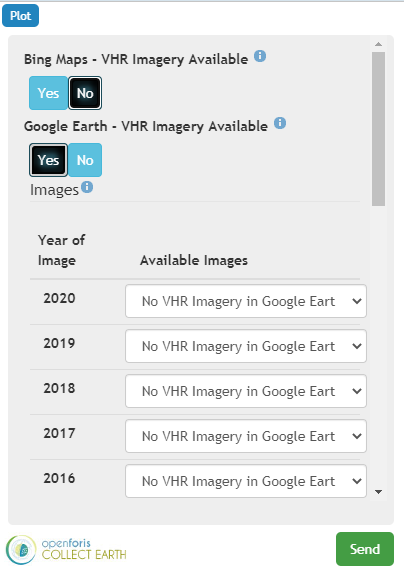
This is a CEP file (that you can open if you install Collect Earth in your computer) that will allow you to collect data on presence of Google Earth imagery and the year of the latest image GE Imagery Available CEP File

You will need to use your own CSV file with the plot locations! This CSV should just have the columns id,YCoordinate,XCoordinate

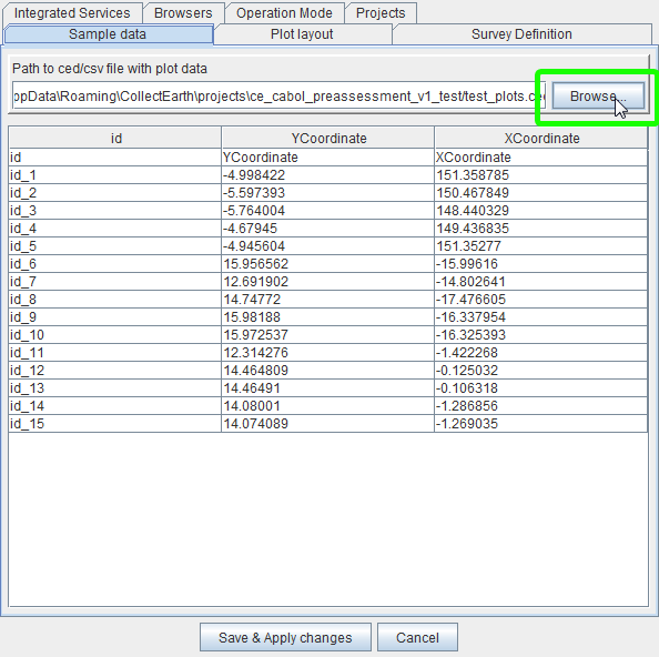
Then you go to Collect Earth click on Properties and choose this CSV with your plot locations:

alt text

permanent link

answered 01 Dec '20, 13:35

collectearth's gravatar image

collectearth ♦
1.0k16
accept rate: 17%

Your answer
toggle preview

Follow this question

By Email:

Once you sign in you will be able to subscribe for any updates here

By RSS:

Answers

Answers and Comments

Markdown Basics

  • *italic* or _italic_
  • **bold** or __bold__
  • link:[text](http://url.com/ "title")
  • image?![alt text](/path/img.jpg "title")
  • numbered list: 1. Foo 2. Bar
  • to add a line break simply add two spaces to where you would like the new line to be.
  • basic HTML tags are also supported

Question tags:

×281

question asked: 01 Dec '20, 08:25

question was seen: 1,202 times

last updated: 01 Dec '20, 13:37