|
Hi I am trying the grid generator for the first time and I find the horizontal distance between points not what I specified. When I specify a 100m systematic grid the vertical distances is 100m but horizontal distance about 60m. Have tried larger distances and different regions but horizontal distance is always about 60% of the vertical distance. Can anyone advise? Thanks. |
|
This issue has to do with the projection that you are using when you generate the grid. The default projection used in the Grid Generator is EPSG:4326. This is a general purpose projection which will work best around the tropics or if you need to do a global grid. This projection is an attempt to make the globe´s sphere into a 2D plan.... this distorts the areas far from the equator ( if you see a 2D map you will notice that countries such as Canada appear much larger than their real size on a sphere, this explains why the latitudinal distance is not right in your grid ). You can read more on this in this article What you need to do is find the best projection for the area where you are generating the grid for. For instance, if you generate a grid for Belgium and you use the default projection the latitudinal distance will not match the longitudinal. You will need to use a projection more appropriate for the country like EPSG:31300 : Check this example You can find the most suitable projection in sites such as this one : https://epsg.io/ You set the projection in the grid generator:
|
|
Thank you for explaining the projection issue. This has solved the distance issue now. However I am hoping to generate a 100m x 100m plot to fit inside a small patch of woodland and I struggle to get the position right. If I define the area I want using a polygon just larger than 100m x 100m the grid generator seems to only generate two points instead of the four points I need. Does the underlying process use a a random start point for the grid rather than attempt to fit the most number of points inside the defined area? |
|
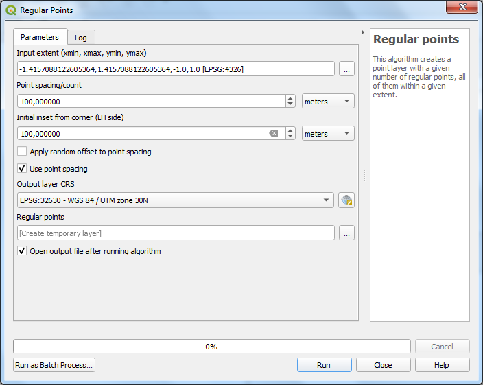
The starting point is not set by the AOI so yes, in a way it is kind of random. If you need to control this, you might be better off using the QGis Vector->Research Tools->Regular grid tool which has finer control over the starting point parameters!
|


