|
Hi Can someone please tell me what are the required fields, the required formats and the required order of fields to make a custom dataset for accuracy assessment using Collect Earth? I have id, y_location, x_location, slope, elevation, aspect...but it still will not open in CE...well...it opens but will not allow data entry. And, when I try to import the .csv using the tools -> import -> update records using CSV it throws an error saying field definition error WRONG COLUMN NAME... Anyway...I know this is somewhere in the UserGuide but I cannot download that just now. |
|
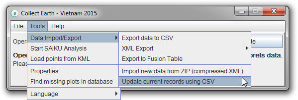
Hi! Here there are two problems: 1. How to import the sampling designFirst the "Tools -> import -> update records using CSV" feature you are trying to use is NOT used for importing the sampling design.
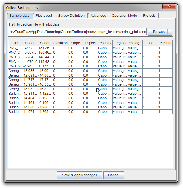
So the menu item saying "Update current records using CSV" means that the information on the database that has already been collected can be updated using a CSV file. This is not used for importing a sampling design. Say that you would like to update the value of the ecological region that the plots in a region belong to. You would do that here. See how here : link. You will need to import your sampling design by clicking on "Tools->Properties" and then use the "Browse..." button to open the CSV that contains the sampling design.
\Now to the second problem : 2. How to create your own sampling designOk, this is a bit more difficult. In Collect Earth the minimum requirement for a sampling design file (the CSV that contains the plot locations) is a file with headers like so: It is important the order of the columns, so id,latitude,longitude should be in that order! But this is the "starting point". So if in your Collect Earth survey you have included attributes like elevation, slope and aspect that are marked as coming "From CSV" in the Collect Survey designer, these have to be included on the sampling design.
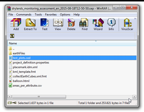
So you if you have elevation, slope and aspect as coming from the CSV you need to add them to the CSV with the same order they were defined on the survey. So you get a CSV/CED with headers If you want to know the format that is expected for your survey the easiest thing to do is to check the structure of the data on the file called test_plots.ced inside the CEP file create by the Collect Survey Designer. This file is generated dynamically for the survey so it contains the exact format expected for the survey.
|
|
Hi And thanks for this. I should have also said that I had tried many times to import the points using the proper method you describe above...and one that I have used in the past to properly import points. I also checked my previously successfully imported files to make sure the format of the custom file was in the same format...and it was. The points imported, and I can see them in Google Earth...and the custom legend bubble pops up. But, when I click on 'Send'...nothing happens. So...I was trying to troubleshoot the errors... So, checking the error log the first time I see.. [AWT-EventQueue-0] org.openforis.collect.earth.sampler.processor.KmlGenerator: Elevation Slope and Aspect could not be read correctly java.lang.NumberFormatException: For input string: "" So...then I REMOVE all Elevation, Slope and Aspect from the schema and the input table...because for accuracy assessment it really doesn't matter...and then I try again to add the table. But...then I get an error saying the CollectEarth Server is not running... So...bottom line is that I have an input CSV with ID, Latitude, Longitude...and I want it to work. |


