|
Are there instructions for creating a custom project file for CollectEarth? |
|
Hi, could you please be more specific in terms of what starting datasets you would have and in what context? Thanks, Giulio |
|
Hi Yelena I can't answer regarding the HTML balloon customization, I don't think there is any easy functionality still, but I can give some details on project files. A project file for CollectEarth is a zip file essentially containing :
You can find examples under c:\Users\YOUR_NAME\AppData\Roaming\CollectEarth\projects\ (in Windows) If you have a set of HTML balloon and associated files ready, and only want to change the location of points and the title of the project, you can duplicate one of these projects, change the necessary files (csv and properties) and compress as a zip. Note that the folders have to be zipped at the root of the archive, with no intermediate folder. This will create a customized project file as a zip that you can share and open in Collect Earth. |
|
I was just attempting to customize for Ethiopia. However, doesn't look that easy. So, looking forward for this documentation! |
|
Hello, is there any new information regarding the creation of a customized project? Alternatively, is it possible to download classification schemes of different CollectEarth versions, other than the one on the main download page? I'm interested in the classification scheme that has been applied in the Papua New Guinea Collect Earth version (see CollectEarth tutorial). Is it possible to download that version or get access to the related HTML files? Thank you for advice, Katja |
|
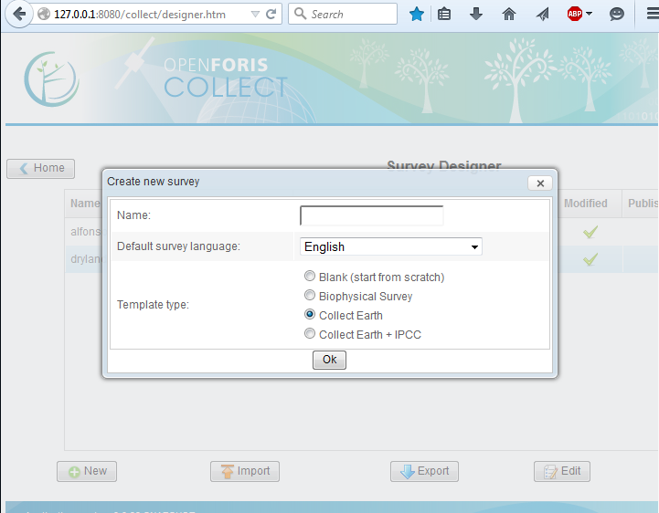
Hi Katja, we are working on the Collect Designer survey export to Collect Earth Project files. This will greatly improve the way that a user can design its own survey and working with the already proven Survey Designer. NOTE: This is still in development so it is not working completely. In the next weeks there should be a final version. As it stands right now, if you download the latest version of Collect, you can create a new survey through the Collect Designer using the Collect Earth template which includes the necessary basic fields that every Collect Earth Project :
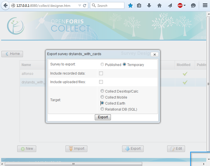
After you add the rest of the variables to be collected to your survey you can export the survey into a Collect Earth format. The result will be a Collect Earth Project file containing all the necessary files and a "test sampling design" with 15 plots around the world. You should then create your own sampling design through QuantumGIS and link it using the Collect Earth menu Tools->Properties->Sample data (tab) From Collect Survey Desinger you can export the Collect Earth Project by clicking once on the name of your survey and then click on export. Choose the Collect Earth export:
Hope this helps! I will also send you another example of a Collect Earth survey for Namibia. |
|
Thank you for detailed instructions, this was very helpful! |